Inner Island Nature Reserve was established in 1992 as a result of a cooperative effort of Denman Island residents, a logging company and the Islands Trust Fund (ITF). It was the first land purchase of the Denman Conservancy Association (DCA) whose volunteers raised the $70,000 purchase price through fundraising events on the island and in nearby Courtenay along with a matching grant from a private foundation.DCA purchased the property from Raven Forest Products of Campbell River and donated it to the Islands Trust to be held as a wildlife sanctuary. It was also the first land acquisition of the ITF. (See detailed history below.)
Two additional parcels of adjacent Crown land are implicated in the Inner Island Nature Reserve: Lot 1, comprising 25.6 hectares of wetland bisecting the Inner Island lands and the crown block, SW ¼ of Section 22 (64.75 hectares), immediately to the east. The ITF Board’s Management Plan for the Inner Island Nature Reserve on Denman Island includes these lands. DCA is the manager of the Reserve for Islands Trust Fund. The reserve is part of DCA’s Central Park Vision.
The creation of the Denman Island BC Provincial Park has resulted in these adjacent crown lands receiving protected status as part of the Park.
Nature Conservancy of Canada holds a conservation covenant on the Reserve.
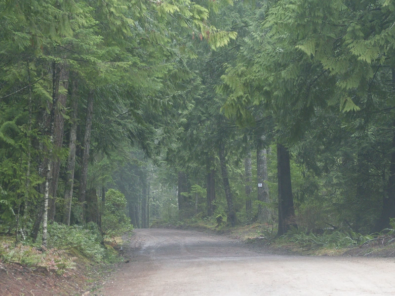
A public walking trail starting on Pickles Road traverses Inner Island Nature Reserve. It continues through Park land and DCA’s Central Park to Denman Road. For equestrians there is a connection to BC Park land from Pickles Road that does not enter the Nature Reserve. The Management Plan for the Inner Island Nature Reserve can be found here.
Forest Values
The Reserve properties are within the Coastal Douglas-fir moist maritime (CDFmm) biogeoclimatic zone
The Reserve area was logged around the turn of the century and the northern part again in 1984. Strips of mature trees, both Douglas-fir and western red cedar, were left along Pickles Road and in riparian areas.
Forest Vegetation
Predominant forests
Douglas-fir with a shrub understory of salal and dull oregon grape
Moist sites
Western red cedar, grand fir and red alder
Very dry sites
Garry oak and arbutus are found on especially dry sites.
Under-story species
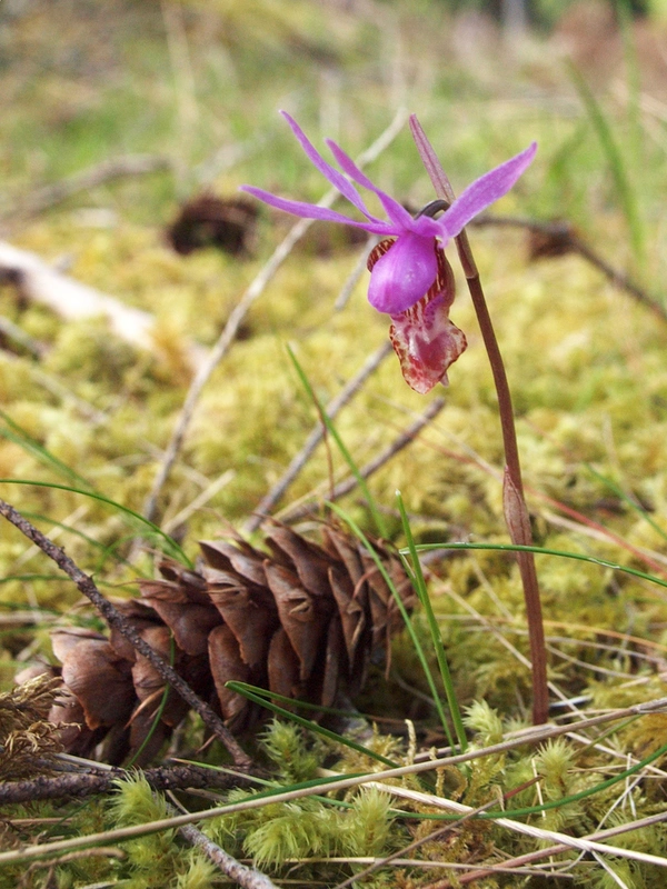
Oregon grape, salal, sword fern, a variety of mosses
Vanilla leaf,red huckleberry, and woodland rose in suitable sites.
Much woody debris, including large moss covered logs, on the forest floor.
Riperian understory
Sword fern, lady fern and skunk cabbage
Pond/marsh Vegetation
Riperian edge
Hardhack and willows
Deeper water
Yellow pond lilies, Cinquefoil, water crowfoot, water parsley, pondweed
Shallows
Extensive patches of sedges
western red cedar snags killed by flooding

Historic Land Uses
A sawmill was located just east of Pickles Road and south of the wetland sometime around 1907. There is evidence of clearing and wooden pilings out into the wetland.
High cut stumps with springboard notches indicate selective logging occurred in the area at the time of the sawmill operation.
A raised roadbed, now overgrown, runs through the southeast portion of the Crown land in Section 22. This is the remaining grade of an extension of the logging railway that originated at Denman Point, traversed the DCA-owned Settlement Lands and reached Denman Road at the Southeast corner of DCA’s Central Park property, opposite the cemetery.

Inner Island Nature Reserve History
Securing the Denman Island lands known as the Inner Island Nature Reserve has been a long and difficult project. In 1993 Des Kennedy, one of the early activists in the cause, documented the events that led to the creation of the Inner Island Nature Reserve and also the Trust Fund Board resolutions to acquire adjacent Crown land. This summary is based on that documentation.
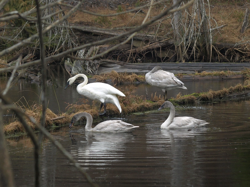
The story starts when it was recognized that the best use of the major wetland on Pickles Road, the beaver pond, was for it to be preserved as natural habitat. This land, slightly less than half of the SE ¼ of Section 21, was donated to the Vancouver Foundation in the 1970’s. The remainder of the quarter section, and other lands, were then sold to Raven Forest Products.
In 1977, at the request of the Islands Trust and the Denman Island Ratepayers and Residents Association, the Vancouver Foundation transferred the donated land, 25.6 ha (56.4 acres), known as Lot 1, to the Crown, intending that it would be held in perpetuity as a nature reserve. This transfer took place with the understanding that the title to the property would eventually be passed to the Islands Trust when it was given the power to hold lands. A map reserve was registered on Lot 1 on behalf of the Ministry of Environment due to the wildlife habitat importance of the wetlands on the property.
In December 1989 B.C. Lands advised the Islands Trust that if the Ministry of Environment did not assume the responsibility of the Lot 1 within two years, the lands ministry would examine alternate methods of protection, and would entertain an application for the land by the Islands Trust Fund, the agency of Islands Trust that had by then been created to hold and manage conservation land.
In September 1990, the Executive Committee of the Islands Trust Council passed a “Denman Crown Land Resolution” in which it was resolved, in part, that the Trust Council was prepared to recommend that the SW ¼ of Section 22 should also be held by the Islands Trust Fund for a nature reserve and watershed protection. This would extend the proposed nature reserve to include the 64 hectares of Crown Land immediately to the east of Lot 1.
The Trust Fund Board, in a meeting of October 19, 1990, passed a resolution to instruct staff to prepare a management plan, and subsequently apply for the acquisition of Lot 1 and the SW ¼ of Section 22.
Creation of the map reserve on the wetland area of Lot 1 isolated two small separate forested portions of the SE ¼ of Section 21, totaling 9.4 ha (21 acres). In December 1992, this property was purchased by the Denman Conservancy Association and donated to the Islands Trust Fund, the first property acquired by the Fund. The two portions of the property were consolidated as ‘Lot A’ and designated the Inner Island Nature Reserve. Subdivision approval had to be granted by the Agricultural Land Commission, which stipulated that Lot A had to be eventually consolidated with Lot 1, the map reserve. On March 11, 1992 the Trust Fund Board passed two resolutions to pursue this consolidation.
It is Trust Fund Board policy to prepare and approve a management plan for properties it acquires (ITFB 1992). Management plans include a biophysical description of the area, an overview of present land use(s) and zoning, the identification of management issues, and recommendations for the appropriate type and level of protection, use, and modifications. On acquiring Lot A the ITF Board prepared a Management Plan for the Inner Island Nature Reserve on Denman Island that included the adjacent Crown held lands: the wetlands and associated uplands of Lot 1 and the SW ¼ of Section 22.
In 2010 the Crown lands adjacent to Inner Island Nature Reserve (Lot 1 and the SW ¼ of Section 22) were transferred, along with other Crown lands on Denman Island, to the BC Ministry of Environment for the creation of a Class A Provincial Park.


